Photography in….Iceland
Overview
Two weeks, in July 2018, driving round Iceland’s Ring Road and out to the Western Peninsula, a trip of over 1,600 miles, through rain, wind, sunshine and everything in between - enjoying and photographing the most stunning scenery and wonderful wildlife.

We had booked a self-drive tour via Nordic Visitor, with the aim of seeing as much of Iceland as possible within a reasonable period of time.
There was, therefore, quite a lot of driving, however the roads, particularly on the Ring Road, were very reasonable and one could cruise along them easily with the car on cruise control set at the 90 kph limit and enjoy the scenery.
That said, there was a lot of winding around fjords and rocky outcrops - added to which some of the roads were just gravel-covered, all of which required considerable attention!
Day 1
We arrived into a wet Reykjavik in early July and, after a quick look round, had something to eat at Icelandic Street Food, ranked No. 2 of nearly 400 restaurants in the city. Quick service, reasonably priced, good food and excellent atmosphere.

The Icelandic Street Food Cafe

Traditional mashed fish and potatoes served with rye bread and seafood soup served in a bread bowl.
Day 2 (ending at Point 2 on the map)
Picked up our hire vehicle (we went with an SUV, given the state of some of the roads, especially in the Western Fjords which were part- gravelled) and headed out on the first leg of the Golden Circle - up to Þingvellir (Thingvellir), the site of Althing, Iceland’s Parliament from the 10th to the 18th centuries . This sits in a rift valley that marks the crest of the Mid-Atlantic Ridge and forms the boundary between the North American and Eurasian tectonic plates.

Þingvellir (Thingvellir)

Between the North American and Eurasian tectonic plates
A short drive on took us to Geysir - from which the word Geyser is derived - to see bubbling streams & pools as well as a geyser which, helpfully, erupts every 5 or 10 minutes.


Strokhur Geyser
Then on to the first of many waterfalls on our trip - the massive Gullfoss. Being on the Golden Circle, it's very popular with visitors who can see a number of Iceland’s key sites within a couple of days. It was therefore very busy when we got there however given its size, there was plenty of space for everyone.
Gulfoss Waterfall
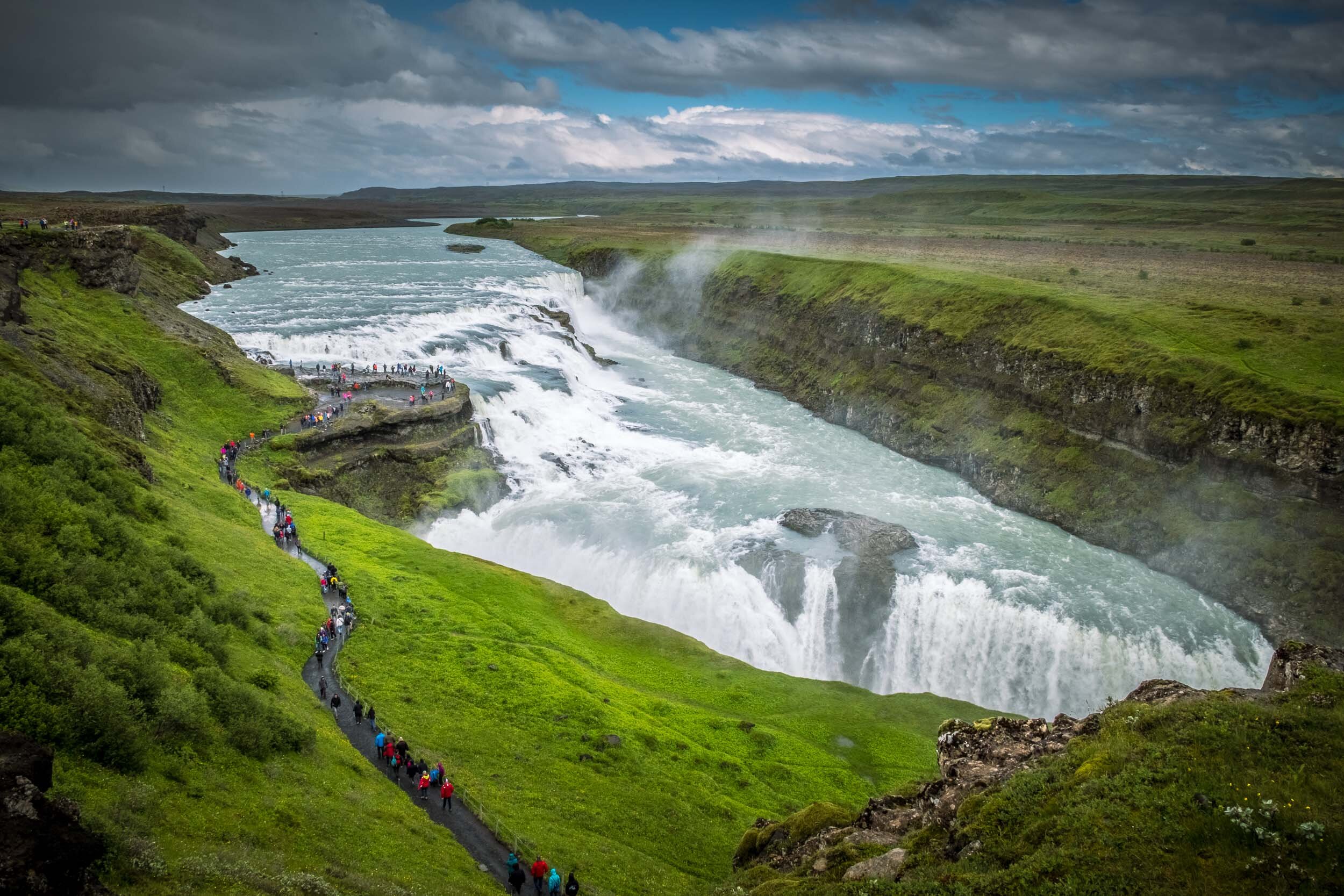
Gulfoss Waterfall,

Tourists watching water flow over the Gulfoss waterfall
When the sun comes out, wonderful rainbows are created so, regardless of the weather, worth a visit.
Whilst this, our first waterfall on the trip, was impressive, there are, we felt, more attractive and less crowded, waterfalls further along the journey
Day 3
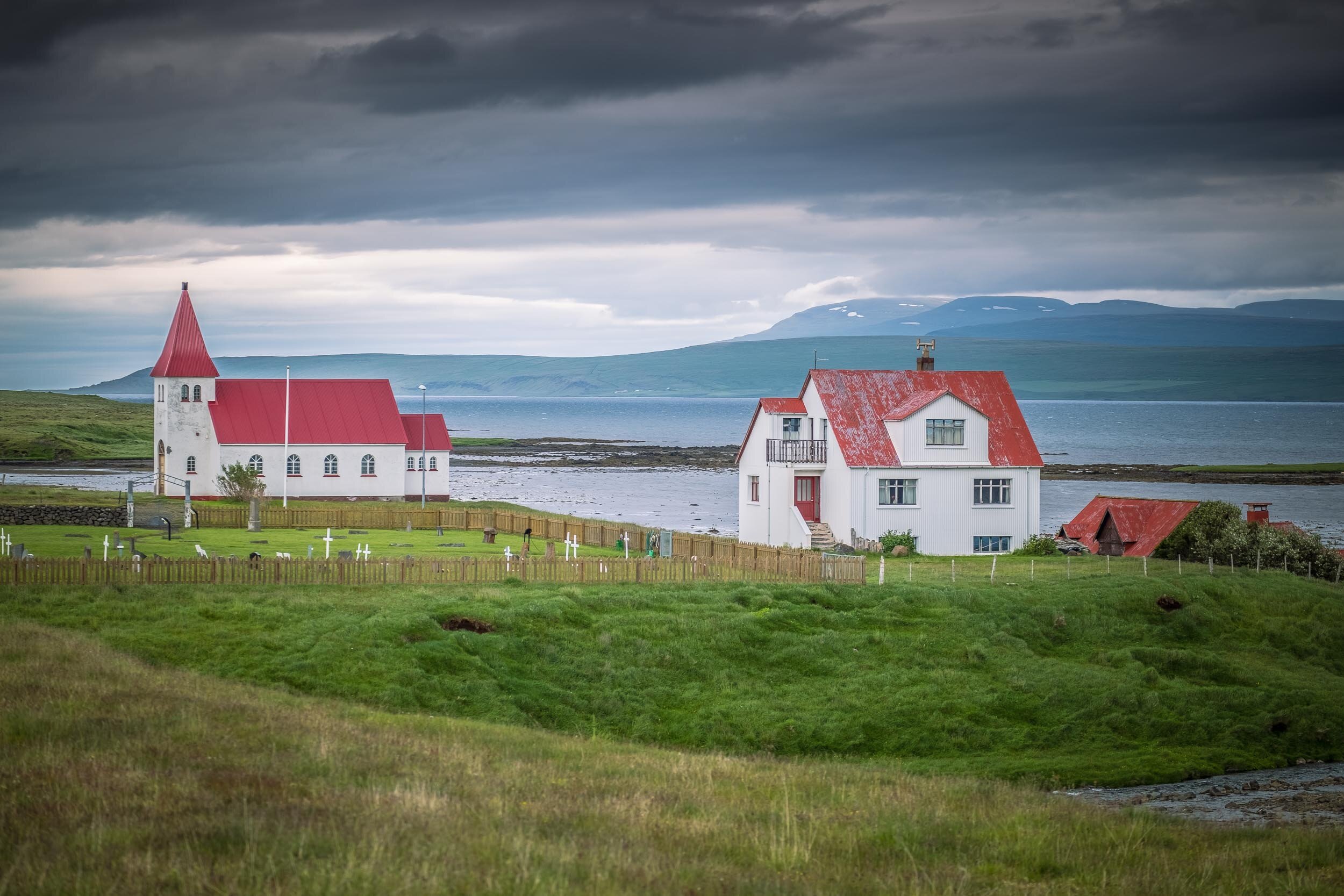
The next day, and getting off the Ring Road for a while, took us through farming country and little villages, characterised by photogenic churches, with bright red roofs set against vivid green grass. We were to see a lot more of these over the course of the next 10 days.
Icelandic Churches

Typical Icelandic red-roofed churches
It was then on to Seljalandsfoss waterfall, popular because of the path that enables visitors to walk round behind the waterfall, albeit getting damp, at the very least, in the process. An interesting experience, one best done in the afternoon / evening when the Iight from the setting sun can be photographed through the waterfall.
Hint: Take a shower cap with you to keep the worst of the spray off your camera.
Seljalandsfoss Waterfall

Two people standing in front of the Seljalandsfoss waterfall

People standing behind the Seljalandsfoss waterfall

People about to walk round behind the Seljalandsfoss waterfall
From here, we drove on to the Solheimajokull glacier where we had booked a glacier walk. This required being kitted out with crampons, safety harness and ice axe - the latter probably more for show. What was amazing was hear, from the guide, how far the glacier had retreated, even in the 5 years that he’d been working there. Look out for groups doing ice-climbing which can make for some dramatic pictures.
Solheimajokull Glacier

Walking towards the Sólheimajökull glacier

A group of ice climbers on the Sólheimajökull glacier

A group of people walking on the Sólheimajökull glacier

On top of the Sólheimajökull glacier
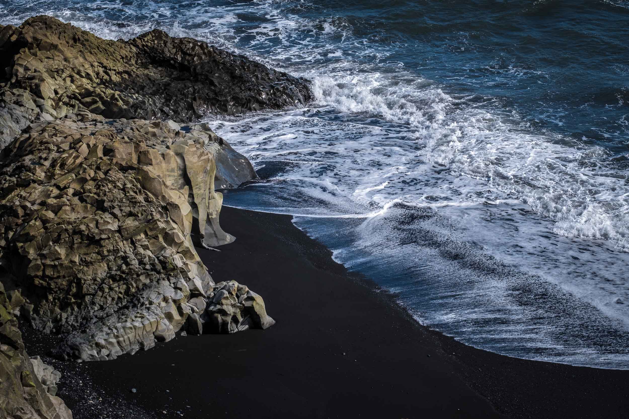
After long walk back down to the base, we drove on to the Dyrholaey Peninsula and Reynisdranger with their the black sand beaches. The latter, with its three rock pinnacles had been recommended however with clear blue sky, it lacked the required atmosphere - a foggy or rainy day would, I feel, have been better.
It was here that we encountered Iceland’s deceptively strong winds for the first time - quite a struggle getting back up Reynisdranger’s beach after photographing the waves around its rocks.
Dyrholaey Peninsula, Reynisdranger Beach & the Ring Road


We finished the day with a long, but very enjoyable, drive along the coast, through miles of Icelandic Lupins - very colourful. By now we were well away from the Golden Circle and so the amount of traffic on the road had reduced significantly.
Another advantage of moving East was that the weather was improving steadily, as we had been told it would - clear blue skies were very welcome!
Day 4
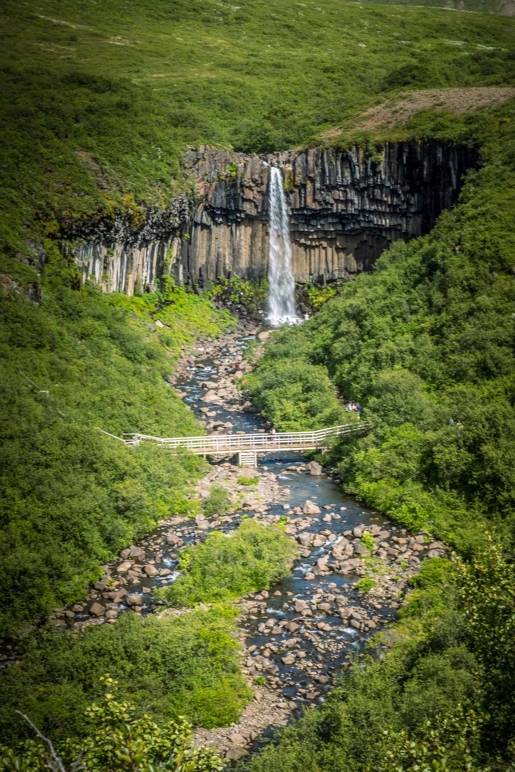
We began the day in the Skaftatell National Park and a walk up to the attractive Svartifoss waterfall with its basalt columns - and a good viewing platform near the base. An early start meant that it was pretty quiet, so I was able to set up the tripod, make use of a neutral density filter and take some longer-exposure photos - albeit it was pretty bright.
Svartifoss Waterfall

The next stop was Jokulsarlon lagoon - known for the icebergs that break off the aforesaid glacier and drift down the lagoon before being swept out to sea where they melt in the sea water. There were a couple of excursion options here, we had opted for the longer, rib-boat trip, which was able to get us up towards the glacier whilst still keeping a safe distance away.
Jökulsárlón Glacier Lagoon

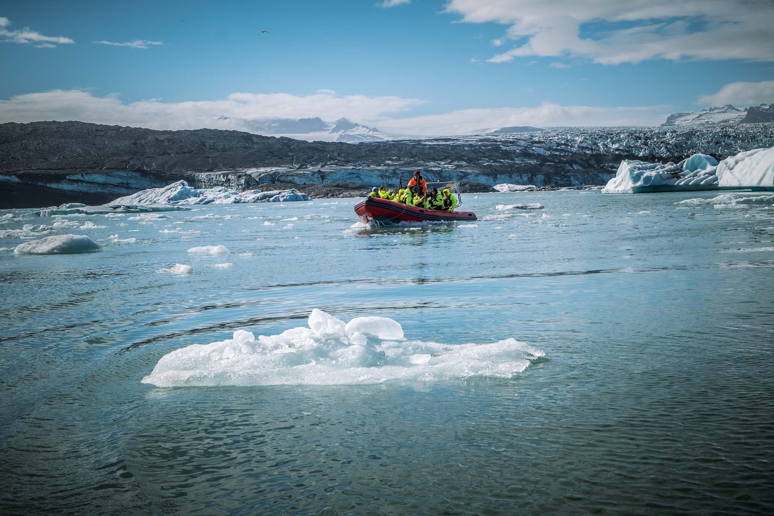


It was here that they filmed the driving sequence in the James Bond film - Die another Day. To do this required damming the lagoon, to prevent sea water from coming in so that they could get it properly frozen for the filming.
Day 5
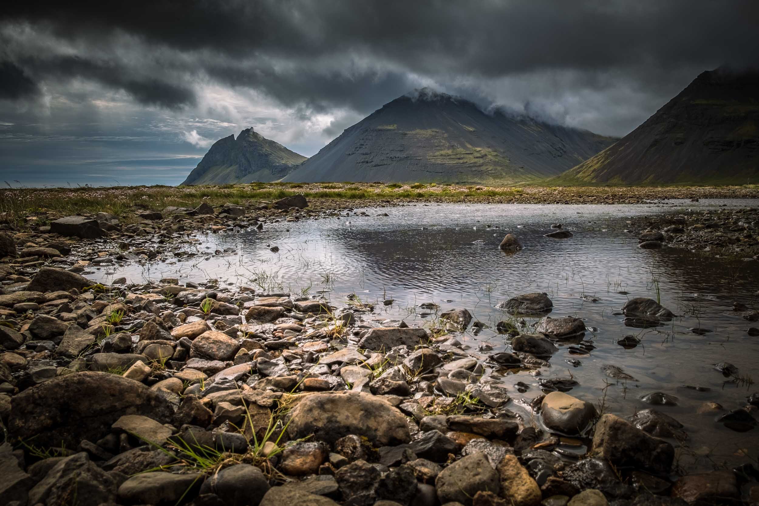
Leaving our overnight stop, just outside Hofn, we drove on along the coast, taking a diversion to the Stokksnes peninsula. The intention had been to photograph the Vestrahorn mountain however the top was covered in cloud but it still provided a moody back-drop to the black sand beach. Definitely worth doing this detour - it really is a stunning location - whatever the weather.
Stokksnes Peninsula

From here it was a long drive through the Eastern fjords to Egilsstaðir, along miles of empty roads. Getting there, we found that the town itself was an uninspiring service and commercial centre however a 30 minute drive over a pass took us to the pretty little port of Seydisfjordur - and a great place for dinner.
Seydisfjordur


Day 6
From Egilsstaðir, it was an amazing and stunning drive along empty roads and across lave fields - eventually arriving at the Dettifoss waterfall. Whilst impressive in size, it was probably the least impressive in the terms of ‘attractiveness’ - the water, unsurprisingly, the colour of the underlying rock - muddy brown and to a large extent, indistinguishable from the banks.
Dettifoss Waterfall


Hint: At the far end of the viewing area, there!s a good location for setting up a tripod and getting some long-exposure images, however the day we were there, the prevailing wind was blowing spray across the lens, so not an ideal position.
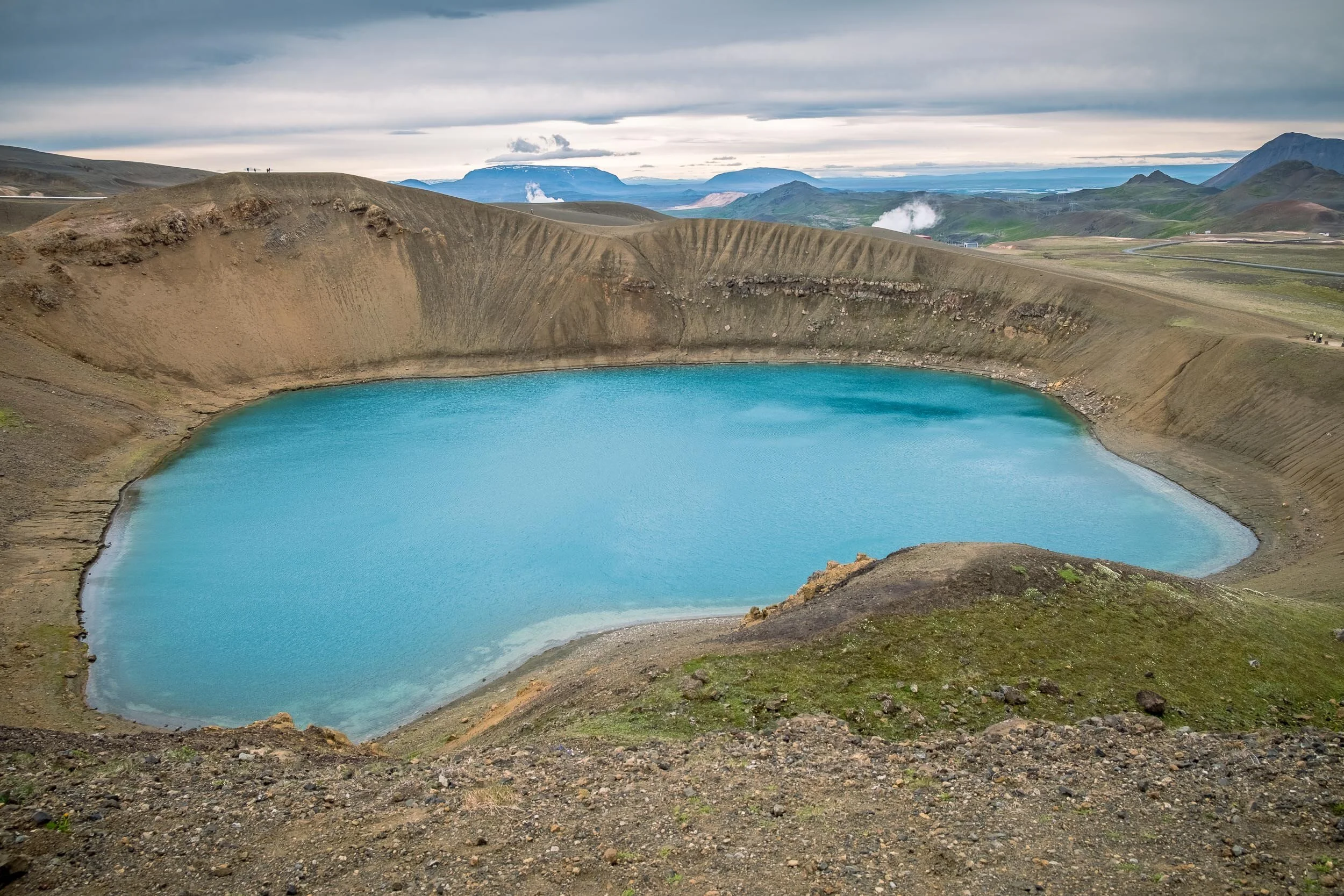
After a relatively brief stop there, it was off the Ring Road and on to the Krafla power plant - to see the vivid blue lake that sits in the Viti crater behind, before heading on to Namafjall thermal area, where there were steaming fumaroles and bubbling mud pots. These weren’t a patch on those seen in New Zealand, but still worth a visit - if just for the lunar landscape where this is located.


Day 7
Halfway through the trip - and half way round Iceland and it was a chance to take a break from the driving and stay in one place for two nights. We took the opportunity to see a bit of the surrounding area around Lake Myvatn and were recommended the Grjotagja lava cave, famous for featuring a beautiful geothermal hot spring - and for being featured in the Series 3 of Game of Thrones.
Outside can be seen the fissure or split in the lava that created the cave in the first place.


We subsequently heard that the cave been closed because people were ignoring the ‘no bathing’ signs - a shame as it’s a stunning location.
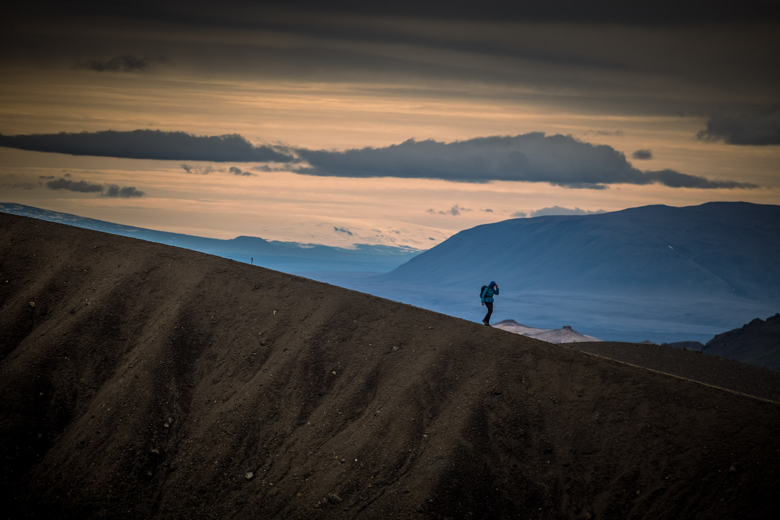
We also walked up to the rim of the Hverfell volcano, with the intention of doing the one mile walk around the perimeter however the wind was so strong that it would have been dangerous to have done so. Instead we came back down and drove over to the Dimmuborgir Lava Field which was worth worth a visit, if just to see lava close up.


Day 8
Godafoss Waterfall was, we felt, probably the most attractive of the many waterfalls we visited - probably also helped by the light there at the time.
As usual, there were crowds of people trying to get close to the water and the obligatory selfie - however kept one of them in the frame for this picture, to provide a sense of scale and place.
Godafoss Waterfall

On to Akureyri, Iceland’s second largest town - an uninspiring service town albeit with an excellent cafe (Kaffi Ilmur) serving excellent coffee - something at which Iceland excels.
After a look round the town we drove on round the headland - said to be more attractive route than cutting across the middle - and through the interesting challenge of single-lane tunnels, several of them. Fortunately there are a few passing places and traffic lights around blind corners but still an interesting experience. It’s here that you reach Iceland’s most northerly, mainland point - 66 Degrees, just after passing through Siglufjordur.
Roads even emptier than before - and there was some lovely light along the way. Note that you are not permitted to stop on the roadside, instead wait for a lay-by, turning - or there are usually places to pull in on either sides of bridges. Overnight at a stunning location on the Hofstadir Guesthouse, in the middle of nowhere - this was the view from the patio of our room.


Day 9
More empty and, by now, gravelled, roads and lovely coastal scenery. Worth a detour to see the Thingeyrarkirkja Church at Thingeyri with its amazing vaulted ceiling.


The other thing / things to note as one drives around Iceland are its horses which generally are allowed to roam - we came across them on various occasions
Overnight at the little village of Drangsnes, the light that evening - around 9pm, was really good - so took the tripod out and set it up near the harbour for some lovely views across the bay.


Day 10
Time to go and see some puffins - so we arranged a trip with a local guide, there was just one other couple with us, an excellent guide and the boat skipper. A 10 minute run across to Grimsey island (note that there are several Grimsey islands around Iceland which causes some confusion) and then a lovely morning walking around the island, photographing puffins, guillemots, shags and other seabirds, many of which were nesting.
Birds on Grimsey Island


Not having a long telephoto, I used Fuji’s 55mm-200mm lens, at the long end, which gave a 35mm equivalent focal length of 280mm, which was sufficient given we weren't far away from the birds.
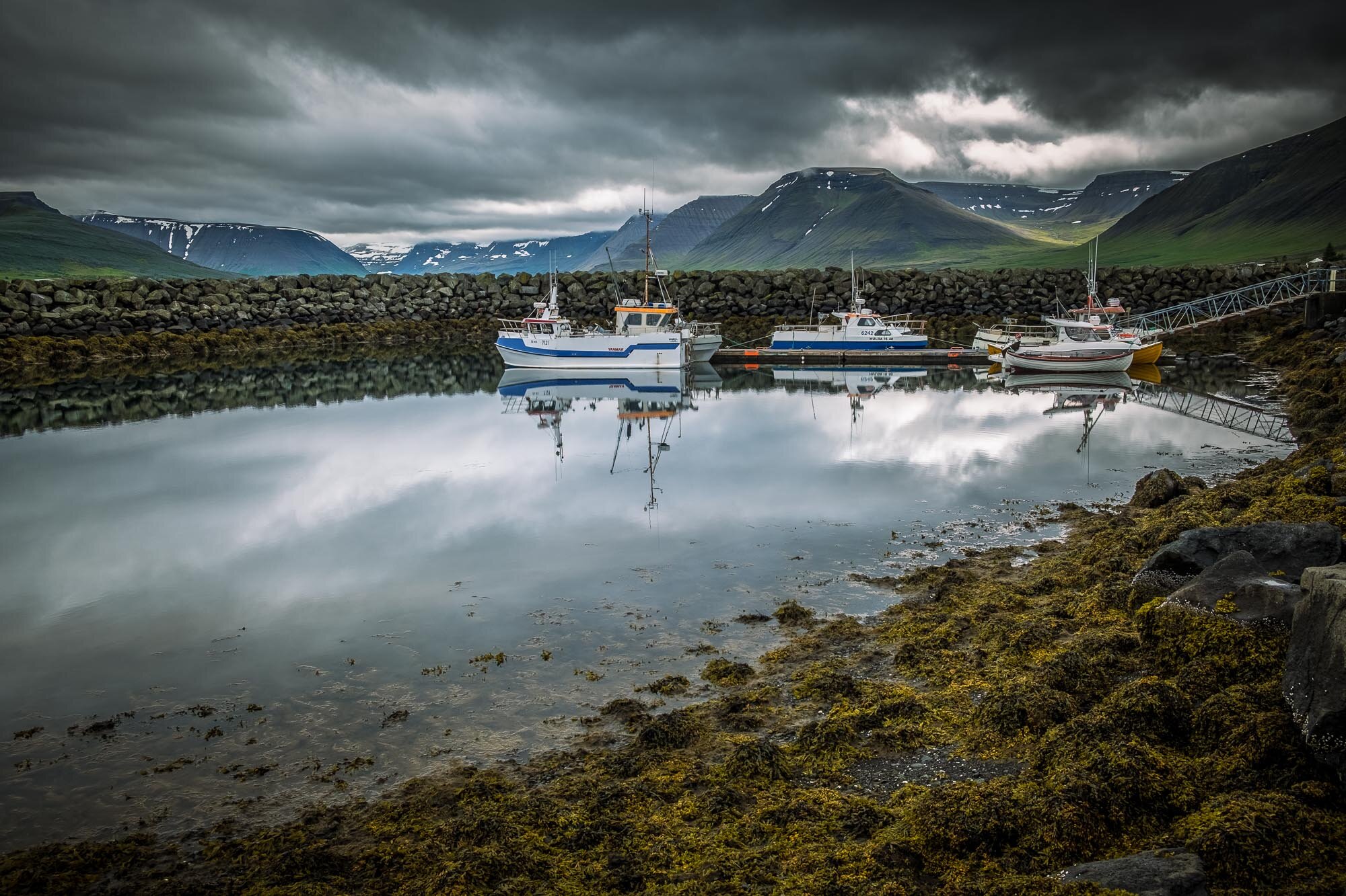
Several hundred images later and back on the mainland, we continued our winding journey, via 6 fiords, to Isafjordur, the largest town in the Western Fiords, with 2,500 inhabitants - old town has wooden houses with corrugated tin roofs built by fishing merchants in the 18th and 19th centuries
Day 11
A damp start however the harbour was quite attractive.
Isafjordur & Thingeyri

Heading out of Isafjordur, we stopped in at the village of Thingeyri for a cup of coffee - Simbahollin Coffee-house (excellent) before heading on over various passes to the Dynjandi Waterfall. Unfortunately, the tyre pressure warning light came on during the journey and whilst a puncture wasn’t immediately evident, given how remote the roads were, we just stopped in briefly there, before heading down towards civilisation.
The first village we came to only had a pump - but no gauge - so I put some air into all of the tyres, not knowing if there really was a puncture and, if so, which wheel was affected.
We were then able to get down to our overnight stop - Patreksfjordur, re-set the warning light and see what happened the next morning
Day 12
The tyre warning light came on again however it transpired that the two garages in town were both closed for the weekend, it being a Saturday morning. Fortunately, Palli, at the Bilaverkstaedid repair shop agreed to open up for us and we were able to get the tyres checked - there was a large screw in one of them - and repaired.
By 9.45am, we were done and ready to go again, so after a look around the little fishing harbour,


we set off on the road again (empty and round the coast) - to Brjanslaekur and the ferry across to Stykkisholmur. This 2 1/2 hour journey saved a considerable amount of time driving around the coastline.

From there, we went on to iconic Kirkjufell mountain - very busy at the car park, by waterfall. Restricted access with ropes cordon along the paths. We did try further up the road, turning right down a track towards a riding establishment but that did not produce the right viewpoint. We then went back to a little turning off the raised embankment, down by the river which was a much better location, empty and no restrictions.


Ironically, given the subsequent change in weather conditions, we would have been better staying in the port town of Stykkisholmur (Pt 12 on the map) which had a very attractive harbour.
Excellent meal in the evening at Sjavarpakkhusid Restaurant, book ahead as it was very busy - and there weren’t too many places to eat in the town.
Day 13
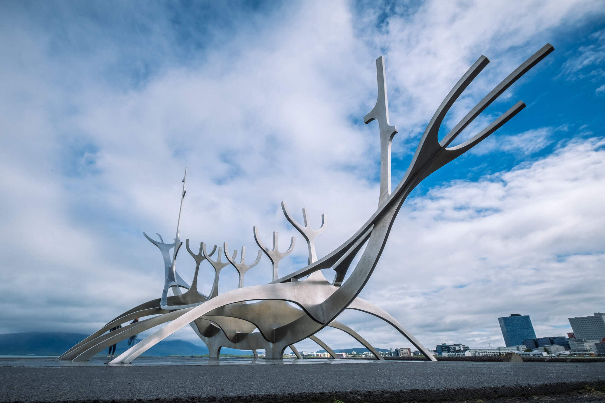
The final day of driving - back to Reykjavik - pretty uneventful, handed rental car back and then walked into the centre to have a look around. It's worth visiting the Solfar Sun Voyager, on the coast road, the challenge was to photograph it without people climbing on it for the obligatory selfies.
Hint: Best view, in my opinion is with wide angle lens, low down and, with the opposing coastline in view.
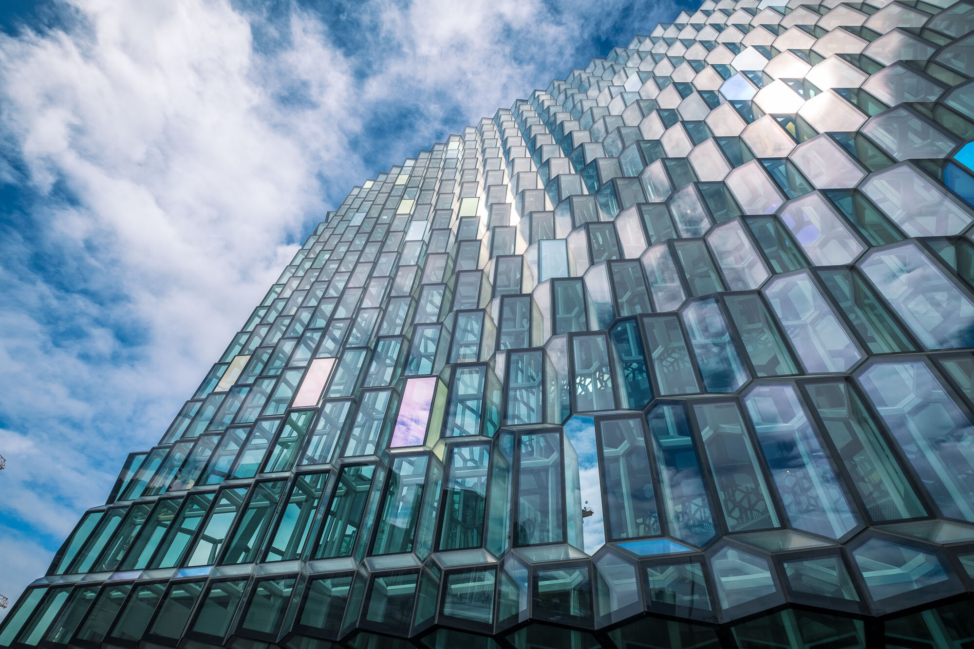
There’s also the Harpa concert hall and conference centre which opened in 2011 - all glass and an impressive building. One could easily spend an hour or so in here just photographing the windows, shapes and light around the building.
For our final dinner, it was back to the Icelandic Street Food cafe, excellent value and, when we were there, rated first out of c1,400 restaurants in Reykjavik
Day 14
To the airport- but via The Blue Lagoon thermal baths, which is close to Keflavik airport. There have excellent luggage storage facilities there and the airport bus does a round trip to & from the airport - so a good place to visit either on the way out of, of arriving into Iceland. Indeed, a number of people that arrive from the US on an overnight flight stop off there on the way into Reykjavik - a great way to wash away the jet-lag!
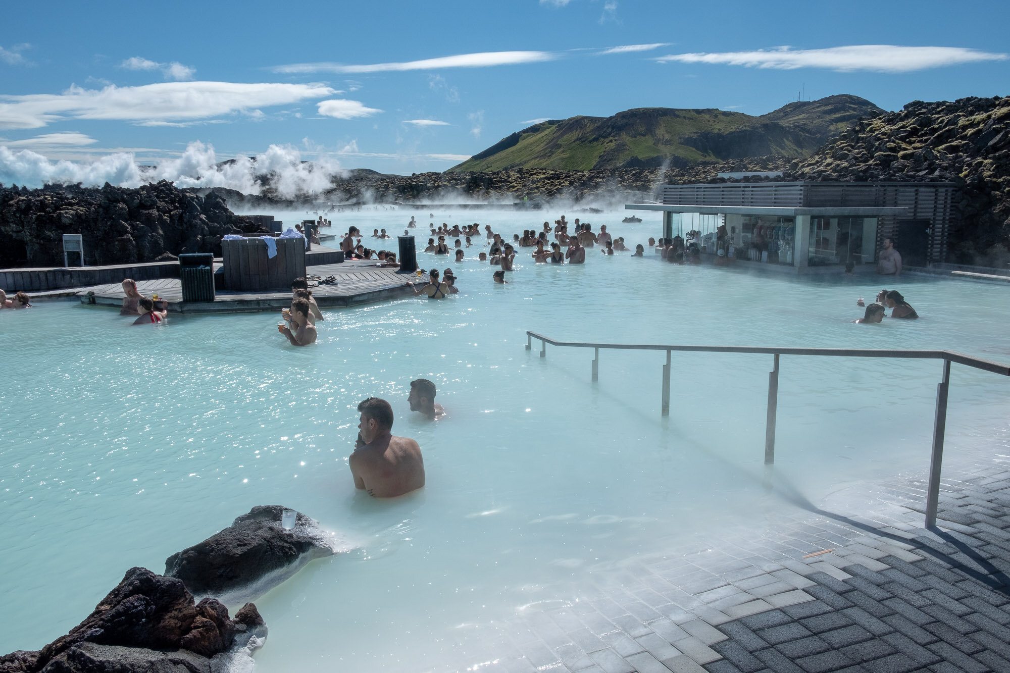
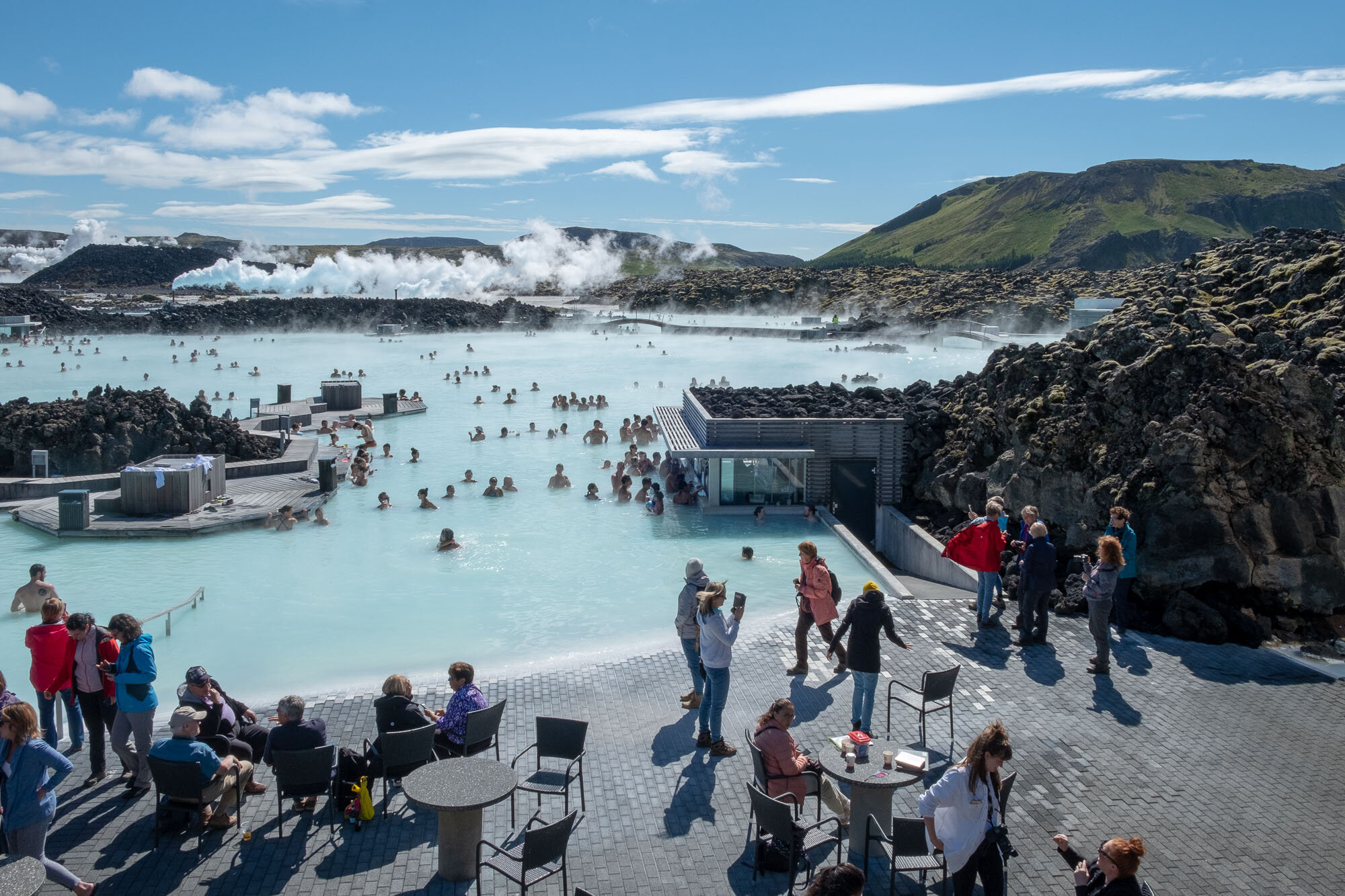
We were sceptical about going but got there reasonably early (9.45am) before the queues and crowds had built up. Didn’t really have enough time to make the most of the place, but it was worth the visit - and absorbed the crowds surprisingly well.
It was then onto the bus, off to the airport and the flight back to London
Conclusion
There’s so much to see in Iceland - waterfalls, volcanic activity, icebergs, pretty little harbours and puffins - to say nothing of the stunning scenery and light, so a two week trip around the entire country cannot really do justice to it. It would also be interesting to see it in different seasons.
Weather:
As regards weather, at this time of the year (July), it's variable - so expect anything from clear blue skies and temperatures nudging 20oC, through to persistent rain via gales and grey skies - and all this can happen within any one day.
We were told that the west of the country was having a particularly wet summer and this manifested itself whilst we were around Reykjavik at the start, and the at the end, of the trip with pretty persistent rain. It was, however, the strength of the wind that surprised us most - on one occasion, we had to use walking poles to stop us being blown over and one had to be careful to avoid car doors being blown off their hinges.
That said, for a photographer, there’s no such thing as bad weather, just poor clothing.
Photography:
It's really all about the amazing landscape and, with a bit of luck, the wonderful light that Iceland seems to have, regardless of the prevailing weather.
This trip was done during the first half of July and so, with the sun setting at around 11.30pm and rising at around 2.30am, it meant staying up late to make the most of the 'golden hour' light. The blue' hour' was more difficult as it never really gets dark at this time of the year. That said, between 9pm - 11pm can provide some nice, angular, lighting and, being close to the Arctic Circle, the sun sets slowly so there's plenty of time to make the most of this.
After some consideration, I decided to take the following equipment:
> Fuji X-T2 body with the 18-55mm walk-around lens, 10-24mm wide-angle (for the interiors) and the 55-200mm telephoto for the land- / sea-scapes
> Filters (Lee Seven5 series) and a tripod for evening or early morning use - also used for some of the waterfall images
> iPad Pro - using the Apple SD card reader, I was able to back up the raw files at the end of every day and then transfer the images into Lightroom CC, both as an additional back-up but also to make a start on reviewing & editing.
During the two weeks, I used the following lenses:
> 10-24mm: 5%
> 18-55mm: 56%
> 55-200mm: 31%
> iPhone: 8%
Recommendations & final hints
> Anywhere in the Golden Circle tends to get very busy, with lots of visitors making the most of a good range of attractions within a relatively short distance from Reykjavik. The attached article, from Guide to Iceland, is helpful in this respect.
> In summer, restaurants also get busy - so book ahead, especially if you’re in one of the smaller towns. Bear in mind also that Iceland is very expensive - £10 for a glass of beer was the norm!
> Photograph the information signs, you'll never remember the names and this will enable you to identify the place when you’re back home
> Take hotel shower caps to protect camera & lens, both when it rains (as it will do) and when near waterfalls.
> Driving - No need for the sat nav, much better, and more reliable, to rely on a reasonably scaled map
> Gravelled roads lead to many punctures, that said we picked up a screw in the tyre, probably from a town, which created the slow puncture.
> Credit cards / cash: Pretty well no need for cash as everywhere accepts, and expects, card payment. Only occasion is to visit the toilets (ISK 200)
So - Iceland really is about the landscape and with the weather being constantly changing, the light is doing just the same. It's a wonderful place to visit, everyone is very friendly, it’s easily accessible from Europe and there’s a wealth of material to photograph.
Any queries, comments, please contact me via the Contact page
Links: